The Amazon rainforest is the world’s most complex biological environment, with millions of species of plants, birds and wildlife calling the vast area home, many of which have yet to be studied by scientists. From 2022 to 2023, the Amazon lost approximately 3 million hectares to deforestation, an average of 10,000 acres per day, according to the Monitoring of the Andean Amazon Project.
Ten percent of the Amazon is within Colombia’s borders, and organizations within that country are applying advances in cloud and AI in a unique approach to fighting deforestation, improving the climate and keeping flora, fauna and Indigenous communities safe from harm.
“It is important to maintain the integrity of the Amazon region, because when we lose integrity, we lose coverage, we lose fauna, we lose flora and the jungle disappears,” says Luz Marina Mantilla, General Director of Instituto SINCHI. “That’s what we don’t want to happen.”
Project Guacamaya is a joint effort of the CinfonIA Research Center at Universidad de los Andes, Instituto SINCHI, Instituto Humboldt, Planet Labs PBC and Microsoft AI for Good Lab that uses best-in-class AI models to monitor deforestation and protect the biodiversity of the ecosystem, through a combination of satellite imagery, camera traps and bioacoustics.
“Technology will be a game-changer in saving the Amazon,” says Pablo Arbeláez, director of the CinfonIA Research Center.
Using data, machine learning, cloud technology, data science and other technology, patterns of deforestation are identified faster, allowing for quicker action to be taken in at-risk areas. The audio language model is a custom-made multimodal language model called CLAP, developed by Microsoft. The image models are trained from open-source models and the framework used to develop the image models, Pytorch Wildlife, was also created by Microsoft.
“I think it shows the best of private sector, NGOs, universities and governments working together,” says Juan Lavista Ferres, Corporate Vice President and Chief Data Scientist at Microsoft’s AI for Good Lab. “This is a great example of how AI accelerates and supports the work of conservationists. We’ve already made significant progress through this collaboration and I’m looking forward to more impact.”
[embedded content]
Several key updates have occurred in Project Guacamaya over the past year, giving researchers more options and better ability to track and understand deforestation patterns, including:
- Daily satellite images from Planet Labs: Prior to this update, imagery was provided monthly. Now, with daily updates, researchers can set up daily alerts using images from the satellites monitoring the Amazon.
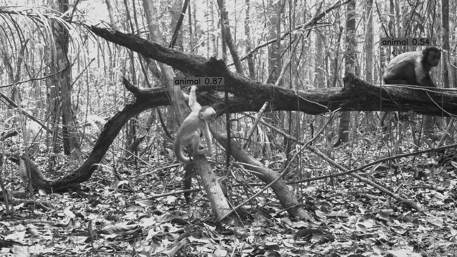
- Amazon-specific AI models: Now, researchers studying animals found in the Amazon can use a region-specific AI model that is more accurate in identifying the species found in the rainforest, allowing them to work 10x faster.
- Governmental collaboration: The Institute of Hydrology, Meteorology and Environmental Studies (IDEAM), which provides the official deforestation reports for Colombia, will now use Project Guacamaya’s models in its reporting.
- Open-source biodiversity model: The project has released Pytorch Wildlife, an open-source platform that is specifically designed for creating, modifying and sharing powerful AI conservation models.
“With this connection of knowledge, institutions and technology, we want the country to move more forcefully in making critical decisions on how to maintain and conserve ecosystems,” says Hernando García Martínez, general director of the Instituto Humboldt. “We need people to understand the value of nature.”
Top image: Amazon-specific AI has made it 10 times easier for scientists studying the wildlife in the Rainforest to identify species found in Colombia, since the model narrows down the focus to animals who live in the region.
Microsoft is a technology company, a small local company, with few employees, no offices, and almost making no profit… >>
Please visit the firm link to site


